Blog Image

Stockport Council News

Midland Rd site/Vale View School

Polluted Land Posted on Fri, March 25, 2016 13:30

http://www.sheilaoliver.org/contamination-4.html

When the corrupt LibDems on Stockport Council stand to make a fast buck, all safety concerns for young children go out of the window.


Responsibilities of landowners

Polluted Land Posted on Fri, March 25, 2016 13:19


https://www.gov.uk/government/publications/riverside-ownership-rights-and-responsibilities

Landowners alongside streams, culverts, brooks etc are responsible for pipes emitting filth.

A few Saniflow toilets aren’t causing that degree of pollution; it’s sewer overflow getting into brooks.


Adswood Biomass Plantation Report

Polluted Land Posted on Fri, March 25, 2016 13:15

http://interactive.stockport.gov.uk/edrms/onlinemvm/getimage.asp?DocumentNumber=212035


Micker Brook sewage

Polluted Land Posted on Fri, March 25, 2016 12:54

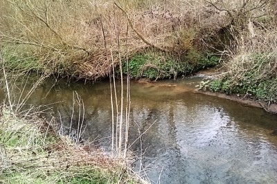
One snap showing brown filth taken from bridge; it’s clearly raw sewage which as
brook drops will turn light grey. It’s all down from before Sandringham bridge.
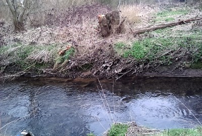
Extensive
products debris on brook bank waterline. High water levels – sanitary products and condoms left
behind by waters departing carrying sewage discharged into our environment.
What else is present we cannot see? Why is this allowed unabated?

Storm
overflows on combined sewers designed to carry sewage away to brooks streams on
hard rain. Intensive building on inadequate sewers, more run off from roads etc
means sewers cannot cope and increasingly sewage getting into environment.

Witness observation:

Used
condoms which reach alarming proportions in sewers.

Peel
off strips from sanitary towels glue backing.

Plastic
leak barriers of sanitary towels.

Entire
outer casing of winged sanitary towels/incontinence pads possibly from size.

Baby
or cosmetic wipes.

Larger
surgical wipes coloured brown have fabric appearance maybe hospital draw pads.


Background information

Polluted Land Posted on Fri, March 25, 2016 08:05

The culverted stream entering the proposed Persimmon Homes site from
Melrose Crescent, Adswood from Davenport playing fields. It then flows under the
London railway line and is now culverted across land at the back of the Cross Keys
public house. It then goes under Ladybridge Rd, then flows in open channel behind Lidl
before it is finally culverted under Calderbrook Drive estate, entering the Micker Brook at Warwick Close bridge.

That stream was
monitored by the defunct Rivers Authority – it being so polluted – and even last
year United Utilities tankers were seen behind Lidl vacuuming a substance from the stream
banks. To further complicate matters it isn’t just tip leachate that enters that
stream; the former brickworks and successors have an active sewage discharge
licence directly into the stream.

The placing of layers of soil on the tip to
dewater the land is undoubtably forcing the badly contaminated leachate into
streams and gardens around.

The Council planning website has recently changed
and some information has seemingly been removed. Bluntly all records of actual
tipping there going back to wartime were ‘disappeared’ roughly 1992. Jacksons, unfortunately, had a reputation it seems of allowing anything to be dumped at a
price and, so even if records exist I would query their accuracy.


Condoms/Sanitary towels in Micker Brook

Polluted Land Posted on Fri, March 25, 2016 08:02


BSE burial site?

Polluted Land Posted on Fri, March 25, 2016 07:54

http://www.manchestereveningnews.co.uk/news/local-news/town-has-a-near-miss-as-burial-site-1173888

In 1991 seven truck loads
of cattle were dumped past 1am, according to a witness.


Micker Brook

Polluted Land Posted on Fri, March 25, 2016 07:51

http://www.healthywaterwaystrust.org.uk/index.php/latest-news/42-diffuse-pollution

Pollution had been picked up in the Mersey
coming from Micker Brook.


« PreviousNext »